Engineering students from Birzeit join MIT, Harvard student develop app for detecting Potholes by phone
A couple of years ago, following a visit by Franz-Josef Ulm, a professor of Civil and Environmental Engineering at the Massachusetts Institute of Technology (MIT) and the faculty director of the Concrete Sustainability Hub, a team of faculty members and researchers from Birzeit University, MIT, and Harvard met to discuss the idea of an application they eventually decided to name “Carbin.”
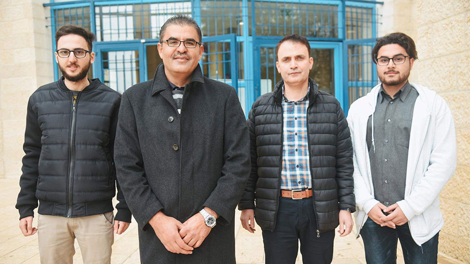
Participating from Birzeit University were the assistant professors at the Department of Electrical and Computer Engineering Wasel Ghanem and Abdalkarim Awad as well as the engineering students Bader Anini and Malek Zek.
Six students from MIT, Birzeit University, Harvard University, UMass Dartmouth, and the University of Washington developed Carbin, with Anini and Zek developing its Android app.
During an educational exchange visit to Birzeit University, professor Ulm had noticed that the roads in the West Bank are very rough―an alarming point, as poor road conditions increase fuel consumption. In a New York Times interview, professor Ulm explained that it had come to his mind that the availability of a map that indicates road quality would enable local drivers to better plan their trips along routes that allow them to save fuel and reduce the wear and tear on their cars.
Driving on bumpy roads needs a constant change of speed, which burns more fuel and releases more carbon dioxide. Carbin uses sophisticated math to identify and track the movement caused by a low-quality road, comparing its quality with measurements taken by laser-equipped vans and cars.
On the application’s website FixMyRoad.us, the students explain that they are “working on the mission of creating a transparent global system for collecting and sharing road-quality data to help public and private entities identify where and when to make road repairs that matter the most to our society.” The students aim to contribute to efforts to build a clean environment and reach the goals of the Paris Climate Agreement.
Carbin’s website FixMyRoad.us, developed and designed by a PhD candidate at MIT, offers data that have been collected by hundreds of beta testers (via sensors installed on drivers’ phones), analyzed, and mapped to indicate road quality according to the International Road Index (IRI). The application suggests alternative routes that are more environmentally friendly and reduce fuel consumption.
The application takes into consideration five key factors: safety, traffic density, comfort of driving, fuel consumption and air quality. Carbin seeks to monitor the conditions of roads as well as the associated fuel consumption and carbon emissions to help drivers find better roads. The application classifies road segments in 25% quantiles from best to worse: good (0-25%), average (25-25%), fair (50-75%), and poor (75-100%) and categorizes roads under two labels, i.e., highways and local roads.
The New York Times article states that about 300 regular users have uploaded data from over 3,000 trips, mapping the quality of over 175,000 road miles in 11 countries.